Im in ur google mapz
 12-03-2009, 09:11 AM
#22
Boost Czar


Thread Starter
iTrader: (62)
Join Date: May 2005
Location: Chantilly, VA
Posts: 79,501
Total Cats: 4,079
I know right?! I'm also mad cause they haven't updated the other stretch of road that I passed another van at; dual devil horns would be in this one...

Reply
 0
0

0
12-03-2009, 09:52 AM
#25
Here's what ours looked like.
The boom would stick up about 5 feet above the cab. Little different setup than the camera vans.
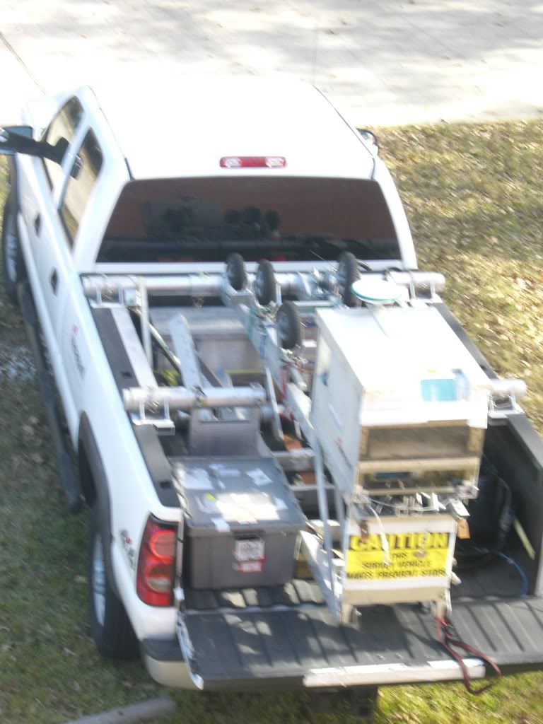
We did LiDAR and not google maps work. Our 3D data for road-going scanners was backed up with photography. Our airborne stuff we just used Google Earth as references for. Occasionally we'd get real aerial photography as well.
The boom would stick up about 5 feet above the cab. Little different setup than the camera vans.
We did LiDAR and not google maps work. Our 3D data for road-going scanners was backed up with photography. Our airborne stuff we just used Google Earth as references for. Occasionally we'd get real aerial photography as well.
Reply
0
0
 12-03-2009, 03:30 PM
#27

52 n quaker ln arlington, va - Google Maps
That really wasn't hard btw...
That street view is the first shot you can see him in (looking north up hill)...just keep trekking up street to get closer pics of our favorite crazy cat guy.
EDIT:
You can google "70 N Quaker Ln Arlington, VA" and look south to see him coming up the hill too.
That really wasn't hard btw...
That street view is the first shot you can see him in (looking north up hill)...just keep trekking up street to get closer pics of our favorite crazy cat guy.
EDIT:
You can google "70 N Quaker Ln Arlington, VA" and look south to see him coming up the hill too.

Frank
Reply
0
0


 12-03-2009, 04:36 PM
#37
Boost Czar
Thread Starter
iTrader: (62)
Join Date: May 2005
Location: Chantilly, VA
Posts: 79,501
Total Cats: 4,079
Those are kosei k1s son.
They are only dirty cause I had to park off trail when I snuck out over to your mom's house last night. I didnt want to wake you with my loud exhaust. you did look cute suckling your thumb while sleeping...
They are only dirty cause I had to park off trail when I snuck out over to your mom's house last night. I didnt want to wake you with my loud exhaust. you did look cute suckling your thumb while sleeping...
Reply
0
0


