The AI-generated cat pictures thread


 10-19-2018, 04:40 PM
Hell yeah! That's me with the black hat on backwards rescuing a sea turtle:
If you can't see it, check Facebook, Pacific Missile Range Facility... for some reason, it won't let me link the page.

If you can't see it, check Facebook, Pacific Missile Range Facility... for some reason, it won't let me link the page.

Reply
 3
3

3
10-19-2018, 07:57 PM
Boost Pope


iTrader: (8)
Join Date: Sep 2005
Location: Chicago. (The less-murder part.)
Posts: 33,026
Total Cats: 6,592
I see it.
How the heck did it get on that side of what appears to be a stone wall. Sea turtles are not well known for their climbing skills, unlike some other kinds of turtles.

(Although I believe that, technically those are tortoises.)
How the heck did it get on that side of what appears to be a stone wall. Sea turtles are not well known for their climbing skills, unlike some other kinds of turtles.
(Although I believe that, technically those are tortoises.)
Reply
0
0
10-19-2018, 09:01 PM
Retired Mech Design Engr
iTrader: (3)
Join Date: Jan 2013
Location: Seneca, SC
Posts: 5,009
Total Cats: 856
Follow-on from DeCamp's post HERE
From UCI Website:

Here is the email address of Morgane Gaultier, Women's Cycling Coordinator, UCI: morgane.gaultier@uci.ch
From UCI Website:

Here is the email address of Morgane Gaultier, Women's Cycling Coordinator, UCI: morgane.gaultier@uci.ch
Last edited by DNMakinson; 10-20-2018 at 04:45 AM.
Reply
0
0
 10-20-2018, 10:45 AM
Boost Pope
iTrader: (8)
Join Date: Sep 2005
Location: Chicago. (The less-murder part.)
Posts: 33,026
Total Cats: 6,592
^ Freakishly good guitar work.
Google Earth is a surprisingly useful tool. I routinely find myself using it for business-related purposes, such as creating an illustration of all of the antennas on top of a tall building which we own or use:
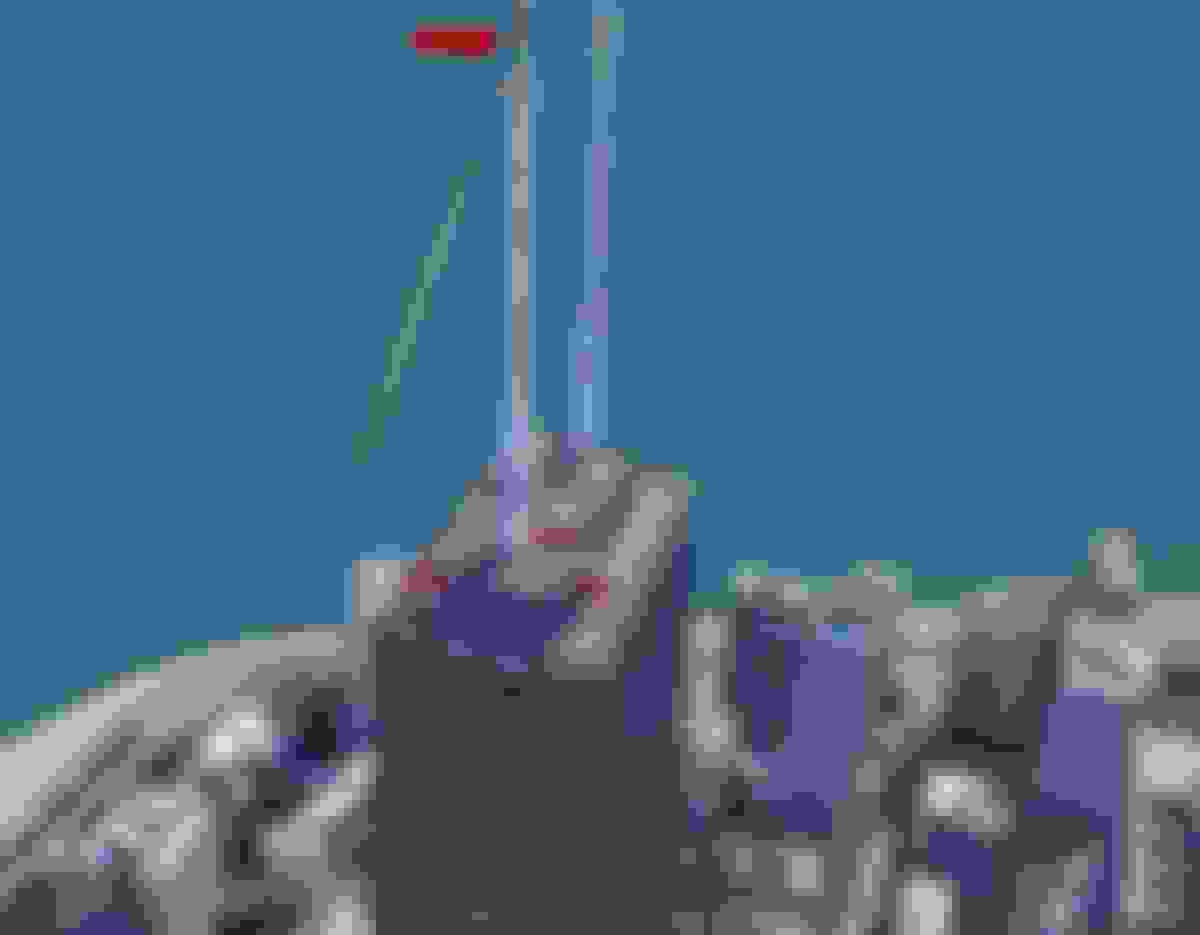
I've photographed each one of these in person, and attached those photos to the lease-amendment document, but it's hard to have a sense of perspective on their placement without an "I am just floating around in free space without limitation" view.
It makes me take a moment of pause, to appreciate the fact that Google has sufficient resources to employ actual humans to manually plot out the geometry of every major building in every major city in the world, and manually apply texture maps to them. So far as I am aware, that process has not yet been successfully automated.
Reply
0
0


